granule.umm_json { "hits": 1, "took": 399, "items": [ { "meta": { "concept-type": "granule", "concept-id": "G1216079418-GES_DISC", "revision-id": 1, "native-id": "AIRH2SUP.006:AIRS.2002.11.16.240.L2.RetSup_H.v6.0.12.0.G14105054018.hdf", "provider-id": "GES_DISC", "format": "application/echo10+xml", "revision-date": "2016-05-05T14:45:25.846Z" }, "umm": { "TemporalExtent": { "RangeDateTime": { "BeginningDateTime": "2002-11-16T23:59:26.000Z", "EndingDateTime": "2002-11-17T00:05:26.000Z" } }, "GranuleUR": "AIRH2SUP.006:AIRS.2002.11.16.240.L2.RetSup_H.v6.0.12.0.G14105054018.hdf", "SpatialExtent": { "HorizontalSpatialDomain": { "Geometry": { "BoundingRectangles": [ { "WestBoundingCoordinate": -163.196578979492, "EastBoundingCoordinate": -139.618240356445, "NorthBoundingCoordinate": -18.9448909759521, "SouthBoundingCoordinate": -42.5188293457031 } ] } } }, "ProviderDates": [ { "Date": "2016-05-05T13:58:30.000Z", "Type": "Insert" }, { "Date": "2016-05-05T13:58:30.000Z", "Type": "Update" } ], "CollectionReference": { "ShortName": "AIRH2SUP", "Version": "006" }, "PGEVersionClass": { "PGEVersion": "6.0.12.0" }, "RelatedUrls": [ { "URL": "http://discnrt1.gesdisc.eosdis.nasa.gov/data/Aqua_AIRS_Level2/AIRH2SUP.006/2002/320/AIRS.2002.11.16.240.L2.RetSup_H.v6.0.12.0.G14105054018.hdf", "Type": "GET DATA" } ], "DataGranule": { "DayNightFlag": "Day", "Identifiers": [ { "Identifier": "AIRS.2002.11.16.240.L2.RetSup_H.v6.0.12.0.G14105054018.hdf", "IdentifierType": "ProducerGranuleId" } ], "ProductionDateTime": "2014-04-15T09:40:21.000Z", "ArchiveAndDistributionInformation": [ { "Name": "Not provided", "Size": 21.0902881622314, "SizeUnit": "MB" } ] }, "MetadataSpecification": { "URL": "https://cdn.earthdata.nasa.gov/umm/granule/v1.6.4", "Name": "UMM-G", "Version": "1.6.4" } } } ] } Builds Granule from granule.umm_json response from CMR.
- Parameters
-
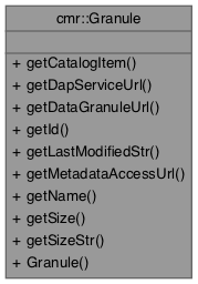
Definition at line 145 of file Granule.cc.